
Landscape burning is an inherent and important part of the Earth system and fires are a necessity in many ecological systems such as savannas and the boreal forests. However, where they burn too close to human habitation, fires can generate hazards to infrastructure and economies, and pose a threat to health and life, both directly and through the impact they have on air quality.
For these reasons, billions of dollars are spent annually worldwide in monitoring landscape fires – particularly larger wildfires – and where necessary, providing interventions to suppress ‘problem’ fires, minimising their negative impact on biological life and human economy.
Effective intervention to suppress a fire requires that the resources available to fire managers are deployed at the right time and place, appropriately, efficiently. Sometimes a decision is made that an intervention is not required, and the fire only needs ongoing observation to ensure it does not become a problem later down the line. Deciding on which strategy is appropriate for a particular fire ideally requires regularly updated information that is accurate enough to allow for properly informed decisions. Aircraft, some equipped with infrared scanners, have long been used to provide an overhead view of fires needing to be regularly monitored in this way, and in more recent years improvements in the quality and frequency of observations being made by Earth-orbiting satellites have seen an increase in the uptake of satellite-derived information by those involved in fire management. One thing that has really helped in promoting the use of satellite-derived information are the reductions that have occurred in the delay between actual observations being made from space and the derived information being available to users. This so-called ‘data latency time’ has now been reduced to well below two hours, for many Earth Observation systems, meaning that those making decisions can have access to satellite-derived information that is reasonably up to date – which is a clear requirement when dealing with a rapidly changing phenomena such as wildfire. This degree of timeliness is generally as good or better than that provided by airborne infrared imaging for example.
Whilst satellite data is becoming more accepted as a source of actionable wildfire information, one area where they fall short compared to that derived from specially deployed and equipped aircraft is in the spatial detail of the information provided. Whilst airborne sensors can allow images to be produced with pixel sizes of only a few metres or less, most Earth Observation satellites used regularly to provide wildfire information deliver imagery with a pixel size of many hundreds of metres. The wavelengths of the infrared measurements made by many of these sensors means they are extremely sensitive to patches of burning that are extremely sub-pixel in size, but the rather coarse spatial detail on the leading edge of the fire where most of the flaming combustion is taking place can be too low to really provide an understanding of how the fire’s dynamics and intensity vary along the fire line.
The data that will be provided by the new satellites to be launched by Satellite Vu in the coming years, starting in 2023, have the chance to change this situation. These new systems will image the Earth in the same highly ‘fire-sensitive’ infrared waveband used by many current Earth Observation satellites but will do so at a pixel size of just a few metres. This new high resolution will allow for greater location accuracy than what is currently available.
Combined with an ability to rapidly down-link the collected observations to the ground, calibrate it and process it to wildfire-specific information, and deliver this to users with low latency, this high spatial detail information offers the potential to provide a level of situational awareness that up to now has only been available from aircraft deployments. Satellite Vu’s satellites can provide short videos of up to 60 seconds, allowing for the calculation of the speed and direction of the fire front. Furthermore, Satellite Vu’s spaceborne infrared imager can be used to observe the fire affected region both day and night, even through thick smoke, enabling it to always provide data on the location of the fire perimeter and its intensity variations unless meteorological cloud gets in the way. Plus, the extreme sensitivity of the infrared imager to even low temperature ‘hotpots’ means the same capability can also be used to detect any small areas of still-smouldering ground that exist after the main fire has gone through, which may need to be identified and extinguished to avoid these areas being a potential ignition point for a new fire. A related application is the identification of smouldering peat fires that can burn underground, and which tend to be far more difficult to detect with current, coarser spatial resolution satellite data than are fires burning at the surface.

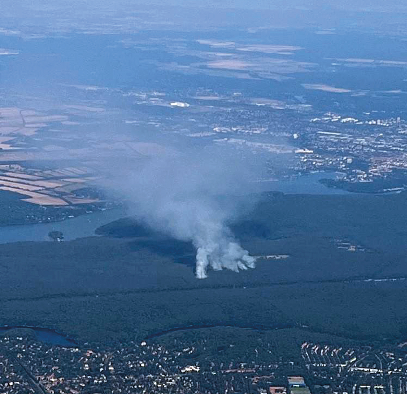
Satellite Vu will be launching its initial infrared imaging satellite in May next year, the first in its planned constellation of eight satellites. Prior to this first launch, the company has been gathering airborne infrared imagery and associated information across the UK, Europe and America to support the development of its many planned Earth Observation data products. A Satellite Vu airborne campaign conducted in August 2022 was able to capture the Grunewald munition depot fire on the outskirts of Berlin. This novel high-resolution image is the first of its kind to be taken with the company’s infrared airborne sensor. With the severity and likelihood of wildfires in certain areas increasing due to climate change and extreme weather events, for example related to lightning strikes, dry spells and heatwaves, the international community must support one another in advancing the most effective technologies that may aid and lower the pressure on emergency services where possible.

‘We are fully aware that the world of wildfire management needs high-spatial-resolution data with minimum latency. Our high-spatial-resolution thermal satellites launching in 2023 and 2024 are Satellite Vu’s answer to the first question. Beyond that, we are working on improving our fire-mapping product timing by incorporating different ways of reducing message latency for tasking and data dissemination, aiming to reduce the gap from hours to minutes,’ commented Tianran Zhang, Thermal Scientist at Satellite Vu.

Remote-sensing technologies are breaking ground in this field by offering a cost-effective and timely solution to the information needs. Furthermore, by applying techniques of machine learning and deep learning to analyse the infrared satellite imagery alongside data coming from other spectral bands, as well as elevation and land-cover datasets, Satellite Vu are looking at creating and improving fire-spread-modelling systems that can predict tomorrow’s fire pattern and ultimately aid those working to save lives. Earlier this year, the company won ‘Best Technical Implementation and Functionality’ at an Amazon Web Services sponsored Disaster Response Hackathon. They hope that such accurate and timely predictions of fire spread could improve disaster response, for example to help better identify areas at greatest immediate risk over the coming hours or days.
For more information, go to www.satellitevu.com
